Cycle navigation tools — what to actually use in 2026
Planning at home, turn-by-turn on the road, sharing the plan across the group — three jobs of a routing tool. Most tools do one or two well. Almost none do all three. Here's the honest map of what cyclists reach for, with the trade-offs I've hit on tour.
The three jobs of a routing tool
Plan. Building the day's route from home on a big screen, seeing the elevation, picking overnight stops that sit at a sensible pedalling distance. This is where the web planner matters — a good one saves hours; a bad one burns them.
Navigate. Turn-by-turn on the head unit or headset, glanceable in bright sun, rerouting sensibly when someone takes the wrong lane at a roundabout. This is the app or unit you're actually using on the day.
Share. Getting the plan into everyone else's heads, phones and units before you set off. Group rides live and die on this — someone always turns up with a different route and you spend the first hour at a café arguing about it.
Most tools do one of those three well. A couple do two. I haven't found one that does all three cleanly, which is why most serious tourers run a small stack — plan in komoot, sync to a head unit, share the GPX in a group chat.
Cycle-specific apps
The planners and navigation apps written for cycling first. Route quality here means climb profile, surface type and food stops — not corner count. These are the four that actually get used on a touring bike.
komoot
Region packs from ≈ £4 · World pack £30 one-offThe default for touring cyclists.
- Strengths
- The web planner is best-in-class for surface-aware routing. Region packs cover the world once for £30 — you own them forever. Voice guidance in a Bluetooth headset works well. The Groups feature is genuinely useful for a small crew. Cycling profiles (road, gravel, MTB, e-bike) all feel first-class rather than bolted-on.
- Weaknesses
- The default 'road bike' profile is aggressive about gravel connectors that aren't fun on 25mm tyres. Adjust the profile if you're on skinny rubber.
- Best for
- Multi-day cycle tours where you want elevation, surface and food stops in a single plan.
Ride with GPS
Free tier · Premium ≈ £65/yearUS-origin, huge in the Anglosphere.
- Strengths
- Group ride 'events' with automatic notifications to attendees are excellent for a club or weekend group. Cue sheets that show at the top of the screen while you ride. Offline in Premium. Route-library sharing culture is strong — most local clubs post their routes here.
- Weaknesses
- Premium is where the real navigation lives — the free tier is deliberately limited. UI feels dated. Elevation-profile detail can lag komoot's.
- Best for
- Group rides that need pre-shared cue sheets and a live 'am I on route' check.
Strava (Routes)
Free tier · Premium ≈ £55/yearNot just tracking — the routes tool is underused.
- Strengths
- Uses segment popularity to weight route choice, so a Strava-planned route tends to be one lots of locals already ride. Turn-by-turn in the app on Premium. Sync to a Garmin Edge or Wahoo takes one tap. Heatmaps are genuinely useful for finding local roads.
- Weaknesses
- Turn-by-turn navigation is Premium-only. The routes tool is buried in the UI. Popular-route bias sometimes over-favours the same climb everyone posts — you end up on the KOM segment when a quieter parallel road would be nicer.
- Best for
- Riders exploring a new area who want to piggy-back on local knowledge.
Bikemap
Free tier · Premium ≈ £30/yearLess known outside Europe, sneaky-good.
- Strengths
- Vast community route database, especially in DACH countries (Germany, Austria, Switzerland) and the Netherlands. Offline in the Premium tier. Gravel and city-cycle modes are both solid. Reasonable free tier for occasional use.
- Weaknesses
- English-language content is thinner than the German-first UI suggests. Some corners of the UI feel busy.
- Best for
- City commutes and gravel exploration, particularly in Germany, Austria, the Netherlands and Denmark.
General-purpose maps
The apps every cyclist already has installed. Not built for cycling, but occasionally the most convenient thing when you're topping up a bottle at a supermarket you don't want to lose the way back from. Free, everywhere, good enough for the airport hop or the hotel lookup.
Google Maps
Free.Everyone's default.
- Strengths
- Bicycle mode is genuinely usable in cities — it knows most cycle-path networks in the UK, EU and US. Directions almost anywhere. Live traffic (relevant when you're on a shared bike lane on a busy A-road). Offline maps by area.
- Weaknesses
- Bicycle routing outside cities is patchy — will happily send you down a dirt track that turns to mud. No elevation profile. No sense of climb difficulty.
- Best for
- City navigation, restaurant lookups on tour, backup when the cycling app can't find the hotel.
Apple Maps
Free.The iPhone-native option, now much better than it was.
- Strengths
- Very readable turn cards on CarPlay and phone. Bicycle mode with elevation profile in most EU/US cities. Look-Around imagery helps with tricky junctions.
- Weaknesses
- Rural cycling routing is thin. Doesn't handle multi-day route planning. Missing detail in the far Alps.
- Best for
- iPhone-committed cyclists who want the OS-native experience for city-scale navigation.
HERE WeGo
Free.The 'everyone forgets this exists' mapping app.
- Strengths
- Best free offline maps in the business. Country-sized downloads that survive an entire tour on one card. Simple UI. Bike routing is basic but functional.
- Weaknesses
- Feature-light on the planning side. No community route library. No elevation profiles for planned routes.
- Best for
- Backup nav for offline situations or trips where data roaming will cost you.
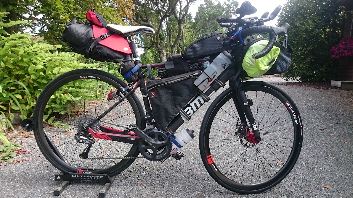
Cycle head units
The bike-specific hardware every serious cyclist eventually buys. A dedicated head unit gives you turn-by-turn plus every metric that matters — power, heart rate, cadence, radar — without draining a phone battery or being subject to your data plan. Four units still worth spending money on in 2026.
Garmin Edge 540 / 840 / 1050
≈ £280–£640 depending on modelThe category leader, whole family.
- Strengths
- Best-in-class turn-by-turn cycling nav. Deep integration with power meters, HR straps, Varia radar, Shimano Di2, SRAM AXS. Multi-day battery life (the 540 solar model stretches this further). Robust GPX import from any planner. Ecosystem that most bike shops already know inside out.
- Weaknesses
- UI is functional, not beautiful. Setup and menu system have a learning curve. The 1050 pushes past £600. Solar-charging premiums are steep for the mileage they add.
- Best for
- Cyclists who race, train with power, or want the most robust bike computer on the market.
Wahoo Elemnt Bolt / Roam
≈ £280–£380Button-driven, phone-first setup.
- Strengths
- Setup happens from the companion app in about five minutes — no menu tree required. Screen is easy to read in bright sun. Hardware buttons work through any glove thickness. The companion app is genuinely one of the best in the category. Effortless komoot and Ride with GPS integration.
- Weaknesses
- No touchscreen, so map interaction is limited to preset zoom levels. Turn-by-turn works but feels less rich than Garmin's. Firmware cadence is slower than Garmin's.
- Best for
- Cyclists who want the essentials done well without wading through Garmin menus.
Hammerhead Karoo 3
≈ £400The best-looking maps in the class.
- Strengths
- Full-colour high-res display makes maps read more like a phone than a bike computer. Android-based platform means third-party integrations (Strava, komoot, TrainerRoad) feel first-class. Community-driven features shipping fast. Cellular option in the newer models.
- Weaknesses
- Battery life shorter than Garmin/Wahoo peers. USB-C charging is welcome but you'll top up more often on a long tour. Ownership shifted to SRAM in 2022 which spooked some buyers; the roadmap has stabilised but the ecosystem still feels smaller.
- Best for
- Riders who value map quality above raw metric depth.
Bryton Rider 460 / 750
≈ £120–£280The budget alternative most cyclists don't know exists.
- Strengths
- Full turn-by-turn navigation at Garmin Edge 130-money prices. Solid multi-day battery life. Sensor pairing (HR, power, cadence) works cleanly. Improving app ecosystem.
- Weaknesses
- UI is dated. Companion app is thinner than Wahoo's. Firmware updates come slowly. UK dealer support is thinner than Garmin's network.
- Best for
- Cyclists who want turn-by-turn and metrics without spending Garmin money — commuters, weekend riders, first-time head-unit buyers.
File formats — GPX, TCX, FIT
GPX is the universal one. Every planner and every head unit reads and writes it. If you learn one format, learn this. A GPX file is just a list of waypoints and, optionally, a track — plain XML, human-readable.
TCX is Garmin's older format, mostly for structured workouts (intervals, targets) rather than routes. Still around; rarely needed for touring.
FIT is what your head unit records to. It holds the ride you did, not the route you planned. Upload to Strava / komoot / TrainingPeaks; keep the GPX for the route library.
Sharing the plan across the group — honestly
Group navigation is not a solved problem, even with four cyclists on modern head units. Two failure modes bite every time.
Same waypoints, different routes. Hand four riders the same GPX and four units will pick four different lines between the waypoints. Each routing engine has its own opinion — cycle path vs quiet road vs the main drag. At a junction one rider's Garmin says "straight on"; the next rider's Wahoo says "sharp left". Both are correct within their own logic.
The peloton spreads out. Traffic lights, a puncture, a mechanical, someone stopping for a photo — a group of four turns into two pairs in ten minutes. If everyone's navigating individually, you re-split at every ambiguous junction.
A few things actually work, in rough order of how much control you want to keep:
Mark the junctions, not the roads. Scatter GPX waypoints at every decision point — every fork, every roundabout, every unnamed lane where the cycle path leaves the road. Give the routing engine less room to invent between them and the units converge.
Nominate a leader, agree the regroups. Pick a coffee stop 20–30km in, then a lunch stop, then a viewpoint. Everyone rides their own pace to each; regroup, chat, ride the next leg. This is how club rides have worked forever. Nobody's frustrated at a junction because the plan is "get to the café", not "match my exact line".
Live-position layer. komoot Groups and Ride with GPS Events show each rider's location on the route in real time. Doesn't solve the different-turn- instructions problem but you know who fell behind, and where.
The paper cue sheet. Print a single sheet per day for the jersey pocket with the route, the overnight address and everyone's phone number. Batteries fail; paper doesn't. Planamoto's printable export is designed for this.
The floor is still: share a GPX so everyone has the same reference. But plan for regroup points rather than expecting the units to agree.
Offline, battery, and the boring truths
Offline maps. Have them loaded before you cross a border. Data roaming is fine within the EU but slow in the mountains. Google, Apple, HERE WeGo, komoot (with region packs), and every dedicated head unit will work without data.
Battery drain. Head units are engineered for multi-day battery life; phone-based navigation is not. Screen brightness at max in July at noon will drain a phone 50% in two hours. Fit a top-tube bag with a small battery bank, or use a head unit for the nav and keep the phone for photos.
Waterproofing. A Garmin Edge shrugs off rain; a phone in a bar-mount case is fine until the seal ages. Head units win in the wet. If your phone is your only nav, a Quad Lock or SP Connect mount with a proper silicon sleeve is worth the money over a stretchy stem strap.
How Planamoto fits
Planamoto handles the plan — the day's stops, overnight address, expenses, checklists, the group. It doesn't do turn-by-turn. That's what your head unit or komoot phone app is for.
On each day of the itinerary you get a route link that opens Google Maps pre-loaded with the day's stops as waypoints — good enough for a coffee-stop tour, not for a Highlands week. A GPX export per day is on the roadmap so you can hand the plan straight to komoot, Ride with GPS or a Garmin Edge without copying stops by hand.
Related guides
Motorbike navigation tools — what to actually use in 2026
Calimoto, Kurviger, komoot, Google Maps, Apple Maps, Garmin Zumo XT2, TomTom Rider, Carpuride, Chigee AIO, BMW Navigator — the honest map of what motorbike riders reach for, with the trade-offs I've hit on tour.
What to pack for a cycle tour through France, Germany, Switzerland and Italy
A cyclist's checklist for cross-border European touring: documents, country-specific cycling rules, kit, the bike itself, tools, navigation, comfort, and the day-before checks.
Fuel prices by country — petrol & diesel
Average pump prices for unleaded 95 and diesel across the EU, UK and US. Refreshed weekly from the EU Weekly Oil Bulletin, gov.uk and the U.S. EIA.
Power plugs around the world — voltages, pin layouts and adapters
A practical reference to the plug types, voltages and frequencies you'll meet on a multi-country tour — plus what adapters and chargers to actually pack.