Motorbike navigation tools — what to actually use in 2026
Planning at home, turn-by-turn on the road, sharing the plan across the group — three jobs of a routing tool. Most tools do one or two well. Almost none do all three. Here's the honest map of what motorbike riders reach for, with the trade-offs I've hit on tour.
The three jobs of a routing tool
Plan. Building the day's route from home on a big screen, seeing the elevation, picking accommodation that sits at a sensible dinner distance. This is where the web planner matters — a good one saves hours; a bad one burns them.
Navigate. Turn-by-turn in the helmet, the voice loud enough over the wind, the screen readable in sunlight, rerouting sensibly when someone misses a turn. This is the app you're actually using on the day.
Share. Getting the plan into everyone else's heads, phones and units before you set off. Almost everyone underrates this and pays for it at the fuel stop when someone's arrived at the wrong hotel.
Most tools do one of those three well. A couple do two. I haven't found one that does all three cleanly, which is why almost every serious tourer runs a small stack rather than a single app.
Twisty-road planners
The apps built specifically to bias routes toward corners rather than the fastest line. Small user bases but strong opinions. This is where you plan a Sunday ride, not the airport run.
Calimoto
Free trial · Premium ≈ £40/yearBest-in-class for planning a detailed route.
- Strengths
- Route shaping is the killer feature — grab the route line anywhere and drag it to reshape it, snapping to real roads as you go. Force the route down that fun back road even when the algorithm wouldn't pick it, without turning the plan into a chain of thirty waypoints. Curviness slider on top of that. Community-shared tours across Europe. Tour recording with the video-highlights feature.
- Weaknesses
- The subscription stings if you only ride occasionally. The router is opinionated in a way that occasionally sends you 20 minutes around a good road just to catch one corner. Voice guidance can get quirky in strong accents.
- Best for
- Riders who plan the route meticulously and want specific roads in the plan — the route shaping is what wins the subscription argument.
Kurviger
Web planner free · Pro app ≈ £10/yearThe cult favourite among planners.
- Strengths
- The free web planner is arguably the best free tool for building a curvy multi-stop route. Clean GPX import/export. Community-scored twisty ratings. Open enough that riders trust it.
- Weaknesses
- The UI is spartan. No polished social layer — group sharing is DIY through GPX files. Voice guidance is basic.
- Best for
- Planners who build the route carefully at home, load it onto a Garmin or phone, and want the road choice to actually be twisty.
komoot
Region packs from ≈ £4 · World pack £30 one-offCross-discipline — hiking, cycling, and lately motorbiking.
- Strengths
- Best web-to-mobile handoff of any app in this list. The planner is opinionated but usually right. Region packs are one-time purchases you own forever. Groups feature is useful for a small crew.
- Weaknesses
- The motorbike routing profile is newer than the cycling one and sometimes misses a good road. Some UI corners still feel cycle-first.
- Best for
- Multi-day tours that mix surfaces (some gravel connectors), and for riders who arrive here from cycling.
General-purpose maps
The apps everyone already has installed. They're not built for riders, but they're free, everywhere, and good enough for the airport hop, the city hotel, or the day you just want to be somewhere by 5pm.
Google Maps
Free.Everyone's default.
- Strengths
- Directions almost anywhere on Earth. Voice guidance is best-in-class. Live traffic. Offline maps by area. The 'share ETA' feature is genuinely useful for a group.
- Weaknesses
- Motorbikes are treated as cars, so no 'no motorcycles' sign awareness and no winding-road bias. Zero interest in the fun route.
- Best for
- Point-to-point when the road doesn't matter, or navigating an unfamiliar city.
Apple Maps
Free.The iPhone-native option, now much better than it was.
- Strengths
- Very readable turn cards on CarPlay and phone. Look-Around imagery for tricky junctions. On iPhone 15 and later a 'Motorcycle' transport type is available in most EU countries. Genuinely competitive with Google on lookups now.
- Weaknesses
- No twisty-road bias. Rural France routing still occasionally does odd things. Missing detail in the far Alps compared with Google.
- Best for
- iPhone-committed riders who want the OS-native experience without another app to open.
Waze
Free.Traffic-first, community-reported hazards.
- Strengths
- Best real-time traffic of any consumer app. Speed-camera and hazard alerts crowd-sourced. Reroutes aggressively around jams.
- Weaknesses
- No offline. Battery hog. Doesn't consider road quality — it'll send you down a farm track to save two minutes.
- Best for
- The daily commute. Not touring.
HERE WeGo
Free.The one everyone forgets exists.
- Strengths
- Best free offline maps in the business. Country-sized downloads that survive an entire Alps trip on one card. Simple UI.
- Weaknesses
- Feature-light on the planning side. No winding-road bias. No community layer.
- Best for
- Backup nav for offline situations, or trips where data roaming will cost you.
Dedicated GPS units
Expensive, single-purpose, but genuinely better in bad weather with cold fingers and a sun-drenched screen. A phone breaks; a Zumo mostly doesn't. Two units still worth buying in 2026.
Garmin Zumo XT2
≈ £500 new · used XT around £300The de-facto motorbike sat-nav.
- Strengths
- Glove-friendly capacitive screen that works in the rain. Bright enough for direct sunlight. Waterproof, tank-tough. BaseCamp and Garmin Explore let you plan on a desktop and sync over Bluetooth. Excellent GPX import — drop a file, ride the route.
- Weaknesses
- Really expensive. BaseCamp is a dated piece of software. The mount and cable setup adds another point of failure to the cockpit.
- Best for
- Serious tourers on multi-week trips, or anyone who wants their phone to stay in a pocket.
TomTom Rider 550 / 500
≈ £350–£500 depending on modelThe main Zumo alternative.
- Strengths
- Winding-roads mode is genuinely good — a slider that biases toward corners without going full Calimoto. Bluetooth headset pairing is straightforward. Cheaper than a comparable Zumo. Traffic subscription included for the lifetime of the unit.
- Weaknesses
- Companion app connectivity has been shaky historically. Sharing routes between two Riders is clunkier than it should be. Software updates less frequent than Garmin's.
- Best for
- Riders who want dedicated hardware without the Garmin price tag.
BMW Navigator VI / VII
≈ £500–£900 (unit only)The OEM route if you ride a BMW — a Zumo, rebadged.
- Strengths
- Deepest integration on any motorbike — the multi-controller wheel scrolls the map, turn indicators talk to the routing, the cradle is engineered by BMW rather than clamped on. Physically bulletproof. Familiar interface if you've used a Garmin Zumo (it is one, rebadged).
- Weaknesses
- Locked to Garmin's platform under BMW branding. Very expensive for what is fundamentally a Zumo. Cradle is bike-specific — swap to a Ducati and it's a paperweight. Newer BMWs push you toward the built-in TFT and the Motorrad Connected app instead, making the Nav VII a shrinking niche.
- Best for
- BMW GS / RT / K owners who want the OEM-integrated hardware experience.
Phone-mirror screens for motorbikes
The category that didn't really exist five years ago. Bar-mounted touchscreens that display CarPlay or Android Auto wirelessly from your phone — so you navigate with whatever app you already use, but on a waterproof, sunlight-readable, glove-friendly display. Cheaper than a Zumo, more flexible than one, but you're still leaning on your phone for the brains.
Carpuride W702 / W902
≈ £280–£450 depending on sizeThe mass-market wireless CarPlay screen.
- Strengths
- You navigate with whatever app CarPlay or Android Auto supports — Google Maps, Apple Maps, Waze, Sygic, komoot, and more. Big 7in or 9in screen. Waterproof. No new software to learn. Wireless pairing from a jacket pocket phone works reliably.
- Weaknesses
- Your phone is doing all the work — battery, GPS, data. Screen depends on that phone connection staying up. Chinese-brand firmware updates arrive rarely. Sunlight-readability is good but not Zumo-good.
- Best for
- Riders committed to a phone app who want a bigger, tougher screen than their phone can offer on its own.
Chigee AIO-5 Lite / Play
≈ £400–£700The category's most polished ecosystem.
- Strengths
- CarPlay/Android Auto mirroring plus a genuinely useful ecosystem — front dashcam, optional tyre-pressure monitoring, blind-spot radar on the top model. Bright screen. Companion app is better-thought-out than the pure-mirror rivals.
- Weaknesses
- Kitted-out prices approach a Zumo XT2. Software is still a Chinese-brand experience with the occasional English-translation quirk. Firmware ecosystem is young.
- Best for
- Tourers who want a middle path between a dumb screen and a full Garmin experience — nav plus dashcam plus TPMS in one shell.
File formats — GPX, TCX, KML
GPX is the universal one. Every app in this guide reads and writes it. If you learn one format, learn this. Most planners export it directly; most units import it from a USB stick or over Bluetooth. A GPX file is just a list of waypoints and, optionally, a track — plain XML, human-readable.
TCX is Garmin's older format. Still around on some fitness devices but you'll rarely need it for touring. If a Garmin unit refuses your GPX, TCX is the fallback.
KML is Google Earth's format. Occasionally appears in tourism-office downloads. Convert it to GPX with a free online tool before importing into anything else.
Sharing the plan across the group — honestly
Group navigation is not a solved problem. Two failure modes bite every time.
Same waypoints, different routes. Hand five riders the same GPX and five units will pick five different lines between the waypoints. Each routing engine has its own opinion on A-road vs B-road, motorway vs scenic. One waypoint every 30 miles is nowhere near dense enough to constrain them. At a T-junction Rider A's Zumo says "turn left"; Rider B's Calimoto says "turn right". Both units are correct within their own logic. The group splits at 60mph and reunites 40 minutes later, tempers frayed.
Same app, different maps. Even with everyone on the same app, a temporary road closure that one unit has picked up and another hasn't will split the ride. Bug in the middle of nowhere.
A few things actually work, in rough order of how much control you want to keep:
Mark the junctions, not the roads. Instead of a GPX with two waypoints (start and end), scatter one at every decision point — every T-junction, every unmarked fork, every fuel stop. Give the routing engine less freedom to invent between them and the units converge. Ten waypoints for a 100-mile day is not too many.
Agree on a first stop, then ride your own ride. Pick a landmark 30–60 minutes in — a café, a fuel station, a viewpoint. Everyone rides their own line and their own pace to get there. Regroup, coffee, agree the next stop, ride. This is how experienced group tourers actually operate. Nobody's frustrated at a T-junction because nobody's pretending to follow exactly the same line.
Follow the leader, no nav. For a small tight group with a rider who knows the road, this still beats every app. Falls apart the moment traffic splits you.
Live-position layer. Cardo Connect Group Chat (with location share), komoot Groups, or Ride with GPS Events show where each rider actually is on the map. Doesn't solve the "different turn instructions" problem but you at least know who took the wrong turn and where they are now.
The paper backstop. Print a single sheet per day for the tank bag with the route, the overnight address, and everyone's phone number. Planamoto's printable export is designed for this. Batteries fail; paper doesn't.
The floor is still: share a GPX so everyone has the same reference. But don't kid yourself that the units will agree. Plan the regroups.
Offline, battery, and the boring truths
Offline maps. Have them loaded before you cross a border. Data roaming is fine within the EU but slow in the high Alps. Google, Apple, HERE WeGo, komoot (with region packs) and every dedicated GPS unit will work without data.
Battery drain. Nav apps eat phones. Screen brightness at max on a summer noon will drain 50% in two hours. Fit a bike-side USB-C or 12V-to-USB adapter so you're topping up as you ride — the hotel-only charging strategy fails on any day longer than 200 miles.
Waterproofing. A dedicated GPS unit shrugs off a passing shower; a phone doesn't. If your phone is your only nav, budget for a proper phone mount with a silicon sleeve, not a stretchy stem strap. Quad Lock and SP Connect are the two mounts most tourers land on.
How Planamoto fits
Planamoto handles the plan — the day's stops, overnight address, expenses, checklists, the group. It doesn't do turn-by-turn. That's what your Garmin, komoot, Calimoto or Google Maps is for.
On each day of the itinerary you get a "Riding route" link that opens Google Maps pre-loaded with the day's stops as waypoints — good enough for most rides, not the twisty-best. A GPX export per day is on the roadmap so you can hand the plan straight to Calimoto, komoot or a Zumo without copying stops by hand.
Related guides
Cycle navigation tools — what to actually use in 2026
komoot, Ride with GPS, Strava, Bikemap, Google Maps, Garmin Edge, Wahoo Elemnt, Hammerhead Karoo, Bryton — the honest map of what cyclists reach for on a tour, with the trade-offs that matter.
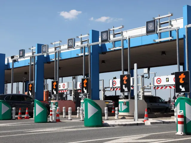
How to use French toll roads on a motorbike
How the péage system works, which lane to use, Liber-t electronic tags, the new Flux Libre barrier-less rollout, group ride logistics, and how to keep costs sensible.
What to pack for a motorbike tour in France, Germany, Switzerland and Italy
A rider's checklist for European touring: documents, country-specific legal kit, riding gear, tools, navigation, comfort, money, medical, and the day-before checks.
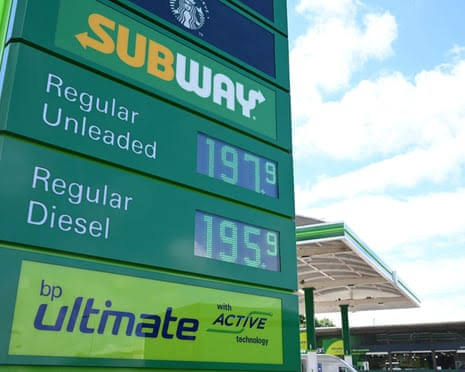
Fuel prices by country — petrol & diesel
Average pump prices for unleaded 95 and diesel across the EU, UK and US. Refreshed weekly from the EU Weekly Oil Bulletin, gov.uk and the U.S. EIA.
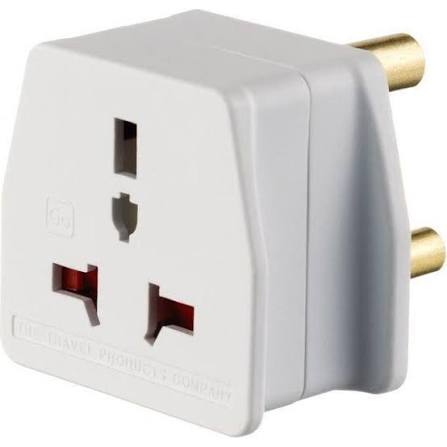
Power plugs around the world — voltages, pin layouts and adapters
A practical reference to the plug types, voltages and frequencies you'll meet on a multi-country tour — plus what adapters and chargers to actually pack.